
Why, it's our brand-spanking-new Maryland 3rd Congressional District, of course!

Under our governor's gracious plan, the whole state is sliced and diced into a eight of *er* creative districts.
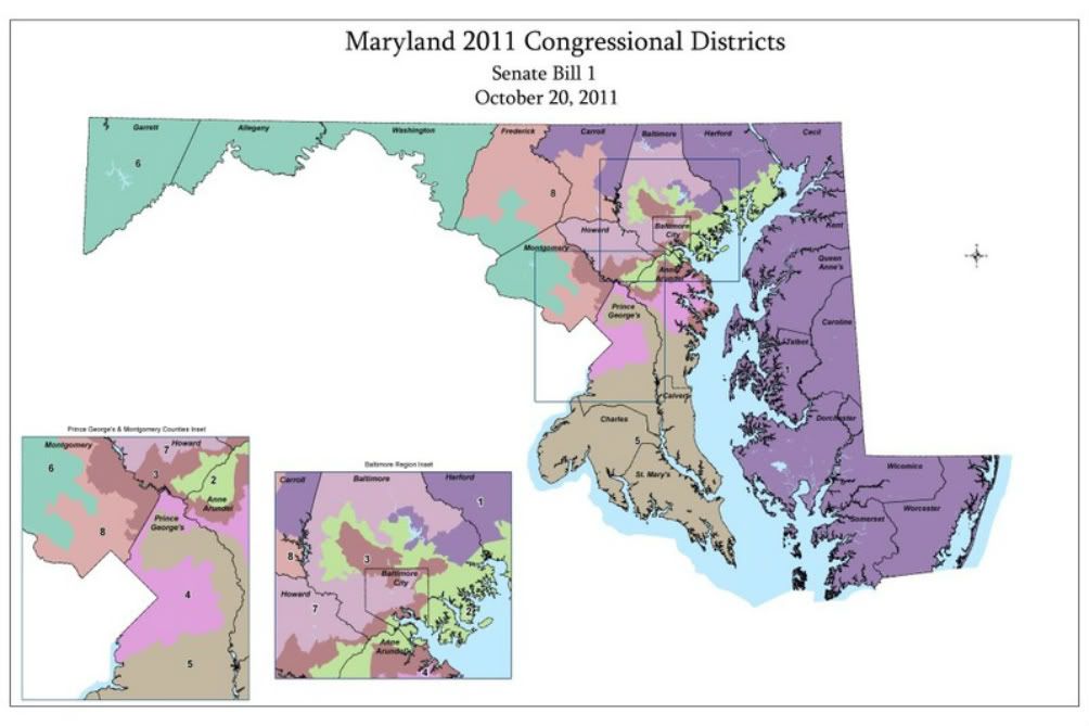
Contrary to common belief, once you get away from Baltimore City, and Montgomery and Prince George's Counties (the counties bordering D.C.), Maryland is quite a conservative state. The problem is, that these three jurisdictions hold the population's center of gravity. Thus, Demoncrats outnumber Republicans 6-to-4 Statewide. So what to do, to strangle the Republican minority into quiescence? Why - Use Baltimore City, Montgomery and Prince George's, as a Demoncratic ATM Vote Machine, of course.
In the case of the 3rd Congressional District, Conservative Baltimore County and Anne Arundel County (Annapolis), is clumped with reliably Demoncratic Montgomery County and Baltimore City. But to do so, the resulting district map must do sinewy calisthenics beyond comprehension. It is so distorted, that the district's western border won't even fit in its official government issued map (See Above).
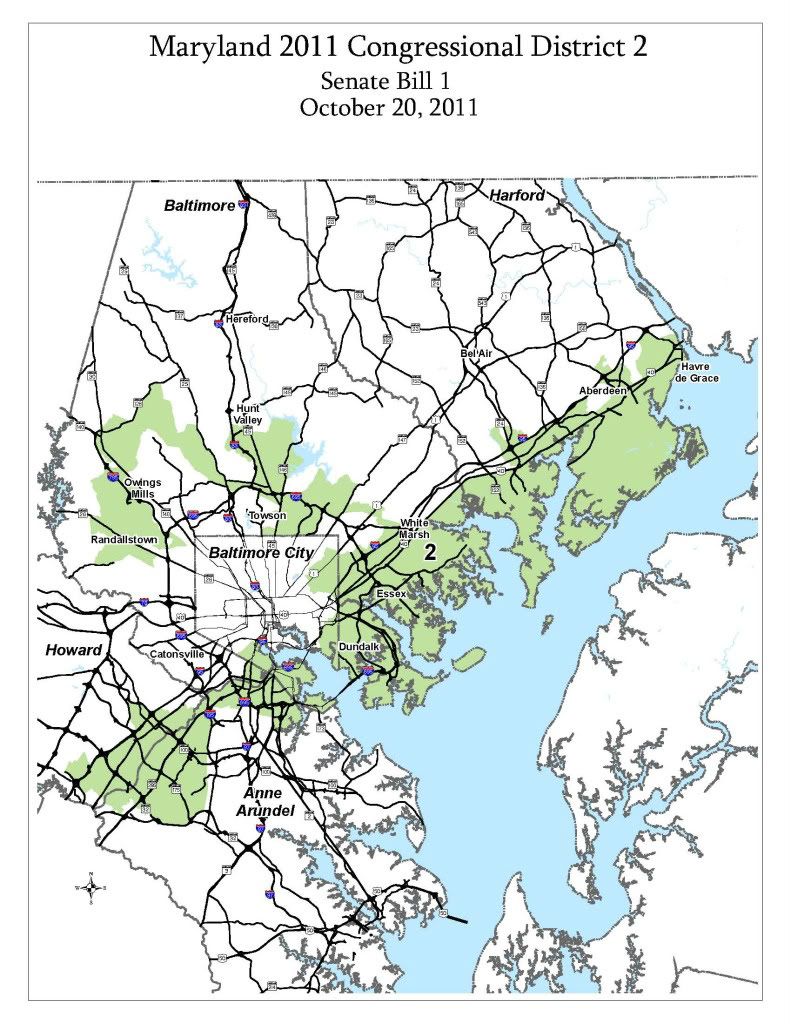
Baltimore City is sliced and diced also by District 2:
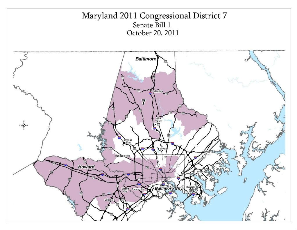
and District 7:
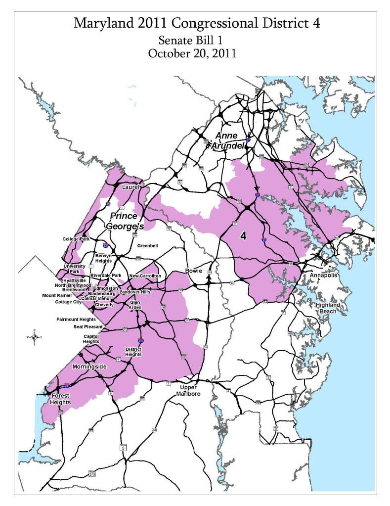
I could go on and rant about the other districts, but I'm gonna let you go with the 4th District. A district that cuts a slippery path from Demoncratic Prince George's County and marries it with Conservative Anne Arrundel County. It's of cold comfort to report that the 4th's, offending borders run just half a mile outside from my home:
Thank-you Sir - May I have another!
Boq

No comments:
Post a Comment